


강원도 철원군 철원읍에 속하는 법정리.
현재 철원읍 소재지이다. 북쪽으로 강원도 철원군 철원읍 월하리,동쪽으로 철원군 동송읍 오덕리, 남쪽으로 철원군 동송읍 이평리,서쪽으로 철원군 철원읍 율이리와 접하고 있다.
면적은 6.05knf이며,2019년 기준 가구 수 1,814세대에 4,205명(남자 2,128명,여자 2,077명)의 주민이 살고 있다.
1914년 화전리(花田里)와 천황지리(天皇地里)가 통합될 때 화전리의 ‘화(花)’ 와 천황지리의 ‘지(地)’ 를 따서 화지리(花地里)라 하였다.
1954년 6월 수복 당시부터 주민들이 입주하였으며 남쪽 일부에만 민간인이 거주하고 이외는 군용지로 사용되고 있다.
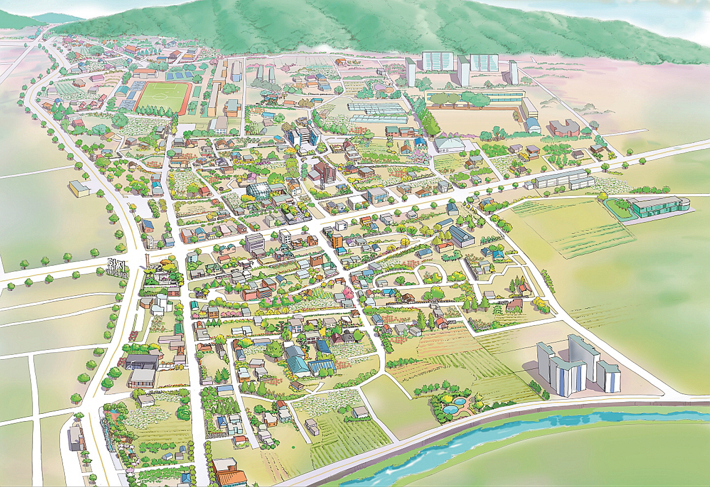
서용철
〈철원 화지리마을 안내도〉
2020
스케치&수채화 채색
59.4 x 84.1 cm
Beopjeong-ri belongs to Cheorwon-eup, Cheorwon-gun, Gangwon-do.
It is currently located in Cheorwon-eup. It borders Wolha-ri, Cheorwon-eup, Cheorwon-gun, Gangwon-do to the north, Odeok-ri, Dongsong-eup, Cheorwon-gun to the east, Ipyeong-ri, Dongsong-eup, Cheorwon-gun to the south, and Yul-ri, Cheorwon-eup, Cheorwon-gun to the west.
The area is 6.05 knf, with 4,205 inhabitants (2,128 men and 2,077 women) in 1,814 households as of 2019.
When Hwajeon-ri and Tienjiri were merged in 1914, they were named after Hwajeon-ri and Tienjiri.
Since the recovery in June 1954, residents have moved in, and only a part of the south has been inhabited by civilians, and other areas have been used as military land.
Seo Yong-Chul
<Cheorwon Hwajiri Village Guide Map>
2020
Sketch & Watercolor Coloring
59.4 x 84.1 cm


